Posts

Showing posts from May, 2014

AT Day 16: All about the food

5/29 thurs Trimpi->Knot Maul 520->557 There is a feeling you get as you head into town. Your pack seems like it is not even there. And you know you will pig out when you get there.  I was told there was some trail magic a few miles from camp. When I got there it had been ravaged by other hungry hikers and I couldn't even get some crumbs. Oh well. I had three clifbars to get me the 23 miles to town. It was begining to get hot and as I crested the last major climb before town I looked up to the sky as if to say thanks God.  Three glorious miles of descent released me out into some green grassy fields. It was 12:30pm, almost the hottest time of day with the sun directly over head. It was brutal and zapping my energy quick. There were a few small rollers that normally you wouldn't even think about. They turned into mini everests' that I was exstatic to have reached the top. Finally, after what seemed an eternity; it was pavement and across a parking lot to the ...
AT Day 15: Two Weeks

5/28 Wed Saunders->Trimpi 477->520 Got up and got out. No knee pain on waking or walking. When the first downhill came, so did the pain.  I didn't let it get me down though.  So my goal today was to hike uphill as fast as possible and do what I could on the downhill.  Turned out to be a lot of climbing on the first half of the day. I was going uphill a lot faster that I had been and only going a little slower downhill. I felt so good, I decided to take a 15 minute break and lay my stuff out in the sun to dry.  When I started back up, I felt great and the knee pain was gone. I had some bomber descents and was really making time. I decided to push on and camp at about mile 518. Which, would give me a 42 mile day. Well as I got to about where I was going to camp, I saw three bears one of which was a cub.  So I decided to book it.  Up over the hill and bomb the two remaining miles downhill to the next shelter.  I was running out of light but...

AT14 Day 14: Set fire to the rain

5/27 Tue Vanderveter ->Saunders 434->477 Easy trail, food re-supply and finishing another state today. Excited as I hit the trail 6:30 am.  Lots of rollers and gradual downhill. I was making great pace. I got my first trail magic today. A church group left a box of goodies for thru-hikers.  I had a MT dew and devils roll. I kept up the great pace but began to notice a little twinge in my left vastus medialis. I tried some massage and playing around. Nothing seemed to work. Then I remembered my running tights .., duh this is why I brought them.  The pain was gone with tights on but slowly crept back. The tights did, atleast mentally, make me feel as though my leg wasn't about to snap in half. I stopped by a shetler to get water and as I was filling up I heard some thunder rolling in. I decided to wait a few minutes to see what happens. While enjoying some instant mash potatoes it began nuking.  So I waited 30 minutes as the storm passed. It must of depo...

AT14 Day 13: Dont go grocery shopping hungry

Image
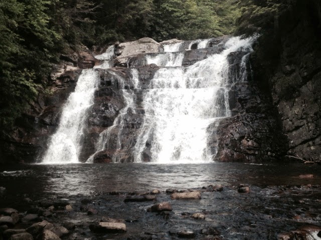
5/26 Mon Mountaineer->Vanderveter 401->434 Rocking and rolling this morning.  Feeling adventurous. So I took the very unused looking trail to Abbys hostel. If it works, I woildn't have to ration food or make the 3 mile round trip into Hampton.  Abbys ended up being more like a half mile from the trail and there was no one there.  Not having good luck with hostels. No worries though.  I hsmmered down to Hampton 20 miles into the day. I got to pass Laurel Falls on the run in so that was sweet.  But it was hot. I had a cliffbar and a chewy to get me. 20 miles. You know how you are not suppose to go to the grocery store hungry .,. Opps. I needed food for today and most of tomorrow before I hit Demascus.  Well I spent $50. But how can I pass up 2 for $3 2 liters of MT Dew?   Anyhow, now I am trying to eat as much as I can, so I dont have to carry it. Walking uphill eating oreos, sardines, poptarts and gummy candy, while drinking MT Dew is not...

AT Day 12: Good days, bad days

Image
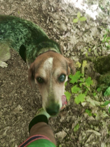
You know that Ive had my share 5/25 Sun  Greasey Creek->mountaineer 366->401 Feeling flat this morning. Lots of climbing today so no rush.  After the first climb the downhill helped me loosen up but still slow.  Hiking up Roan Mountain took a long time but I had a new friend.  I picked up a lost dog and he ran along behind me for 6 miles.  However; he found a female and left me for her.  Over the top I could see the balds that were up next. They didn't look bad. I was excited for the long downhill after the final climb. But my legs were just getting slower and heavier. The balds took me forever and I just felt like I was dying.  Getting on the decent it was covered in roots and big sharp rocks.  I struggled through and had the last 3 miles of smooth trail to open up.  Then I got on the last 8 miles of rolling up terrain. Every uphill seemed like I was hitting a wall.  I couldn't wait to be done for the day. I ate as I ...

AT14 Day 11: Greasey Mistake

5/24 Sat Spivey gap->Greasey Creek 330->366 On a mission today. Trying to get to Greasey Creek hostel. Wifi and a bed to reward myself for 10 good hard days. It was a nice easy trail to start the day.  I made it to Nolichucky quite early. I stopped into the hostel and grabbed some snacks for the climb ahead. Eating and climbing I was trying to avoid the blow up of yesterday.  Up up and up, I was feeling good. Like I said, I was on a mission.  I was dreaming of getting to this hostel and pigging out and sleeping well.  I was almost there and getting hungry.  I could have sworn I should have been there by now. Did I go past it? No it is always further than you think. Holy hell it can be this far can it?  And then I saw it...the shelter that is two miles past the hostel.  I would have just said screw it. But I needed the resuply.  Oh well it is just two more miles.  So I ran back got to the intersection I thought it might be. Afte...

AT14 Day 10: You just had a near life experience

Image
5/23 Fri Little Laurel->spivey gap 293.4->330.2 Congratulations, you just had near life exprience.   I started off my day in the fog again. As I got up to the ridge it felt like it might rain soon. I saw a sign that had two trails, the white blaze AT and a blue blaze Bad Weather trail.  Well I am in for the white blazes. It started to rain, so I quickly threw on my rain gear.  I up'd my pace to keep warm and the storm seemed to be getting worse.  It was like a scene from a movie. A tree fell a ways in the distance. Thunder and lightning were crashing everywhere.  The rain seemed to just be pooring out of buckets. This was getting intense. Suddenly, I realized I was reaching the end of the trees and entering an exposed rocky ridge.  Crap.  So I sat down on my pack and had to wait.  I ate a cliffbar and then another. I didn't know how long I would be there and didnt want to get cold.  About ten minutes later the storm cleared...

AT Day 8: That makes a week

5/21 Wed Pecks Corner->Roaring Fork 217.4->256 Up and out quick. Long day ahead with some big climbs. A few short climbs but a lot of downhill got me 20 miles done in 5 hours. Great pace and gives me plenty of time to finish the 2nd half. At one point I came upon a lady talking on her cell phone in the middle of the trail. I said "good afternoon" and she gave me a look of annoyance as she moved aside.  I was kind of steamed by it, but realized if she had cell service, maybe I do. Sure enough some 4G. I satdown in the shade and posted to my blog for the first 5 days. Finally. After about 10 minutes I was back running. I don't like to take long breaks as I find it kills my momentum. It was getting real hot and I had to walk along a road and then under a highway under pass. I couldn't believe how loud the traffic was above. Glad to be back in the forrest, I had a 5 mile climb ahead of me. One foot in front of the other and I was on top. Snowbird Mountain. ...

AT Day 7: High Point

5/20 Tues Spence Field->Pecks Corner 182.5->217.4 When I woke up and looked out the bear was standing in the middle of our camp.  I said good morning bear and banged a stick on the wood floor.  He took off. I got ready as quickly as possible and got out of there.  The trail ran along the ridge and provide some nice views. The trail hit Clingmans Dome(the highest point on the AT. It was an interesting top, with a spiral ramp to a look out tower. It was a tourist scene and I was freaking out. I took some pictures quick and then vanished into the woods.  It was nice and peaceful on the trail for quite a ways. But then I hit Newfound Gap. Again it was a tourist trap. There was also no water.  I took off a quick as possible to get away from people and towards water. I put on my head phones for the first time in a week.  The music sounded different to me and was very harsh on the ears. I didnt listen long and it was back to my thoughts. It was the f...

Pictures from week one (3)

Image
Top of Cyoah Bald just after sunrise Early bird gets the view Coming into Fontana Dam Biggest dam in the East Spence Field Shelter Good morning bear! Almost to Clingmans I was getting pretty hungry View from Clingmans Dome Such a wierd top of the mountain Newfound Gap Walking on a knife edge ridge More ridge walk Some probably poisonous snake Snowbird Mountain Drying my stuff out before sunset Maxs Patch Good morning owl. Sorry to disrupt your bath Walnut Mt Hot Springs sounds nice

Pictures from the first week (1)

Image
Ready, set, GO!!!! 3" of rain over night:-) I didn't know Georgia had rain forest Finally a chance at a view with some clearing My first trail sunrise One state done Apparently, you have to take a picture of this tree It is so wierd being on top of a mountain and barely having a view because of the forest.  Trees and fog, get use to it...I did Oh and waterfalls.  Glad to be almost to camp, 40 miles done A little sketchy staying here by myself

Pictures from week one (2)

Image
Got to climb towers to get the views Fog My first town This one is for Christal:-)           WARNING Graphic content My feet are a little beat up from swimming the last. 4 days Got to hit the trail early for the view